Home > Maps
2005
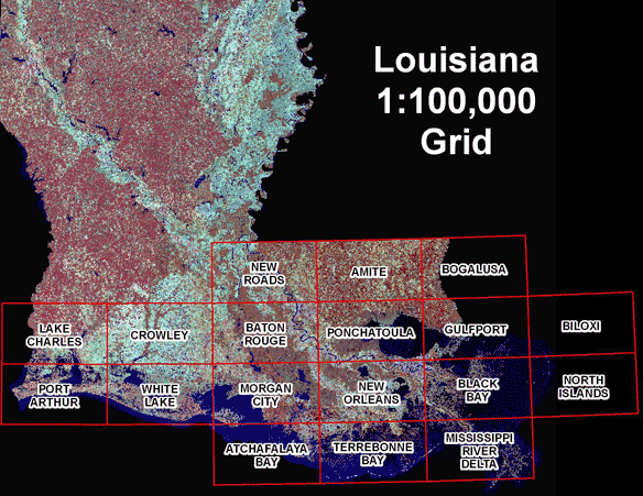
Coastal
Louisiana
Post
Hurricane
Aerial
Photography
These
1-meter
color
infrared
digital
ortho
quarter
quads
(DOQQ)
are
available
in
JPG
and
TIFF
format.
This
photography
extends
from
Gulfport,
MS
to
Sabine
Lake,
LA
and
includes
areas
impacted
by
Hurricanes
Katrina
and
Rita.
Funding
for
the
photography
was
provided
by
the
Coastal Wetlands Planning, Protection and Restoration Act, Coastwide Reference Monitoring Program (CWPPRA - CRMS), with
additional
funding
provided
by
the
Louisiana
Department
of
Environmental
Quality
and
the
U.S.
Geological
Survey
to
expand
coverage
to
assist
in
hurricane
recovery.
This
data
is
provisional.
Although
reasonable
efforts
have
been
made
to
ensure
correctness,
the
data
is
still
in
the
process
of
being
verified
to
meet
National
Map
Accuracy
Standards
(NMAS).
This
process
should
be
complete
within
60
days.