 |
|||||||||
Follow us: |
|||||||||
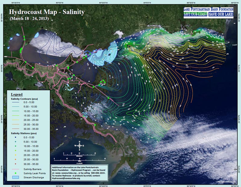
LPBF announces the release of Hydrocoast maps for the week of March 18th to March 24th
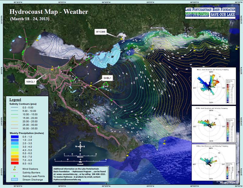
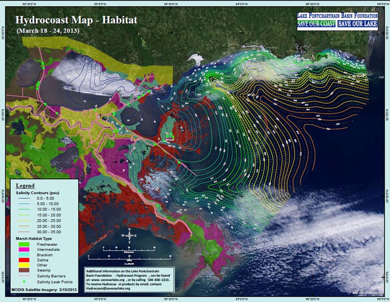
The Hydrocoast program collects a number of environmentally dynamic datasets in an effort to monitor the condition (salinity component) of the basin’s estuaries. Wind, rain, tides and freshwater influx from streams and diversions are variables that cause salinity fluctuation, and play a vital role in the health of the basin’s estuaries. The Hydrocoast program monitors these variables over a seven day period and produces bi-monthly map products showing the movement of water and salinity across the basin (using field data, MODIS, sattelite imagery, precipitation data, wind data and permanent monitoring stations in the basin such as USGS buoys, Coastwide Reference Monitoring System (CRMS), etc.). As a tool, these map products can be used for scientific discussion, restoration planning between state and federal agencies, and by the commercial and recreational fishery community.
The Hydrocoast maps for the week of March 18- 24 show a trend of saline water migrating inland after a large freshening event in the weeks prior. There was no rainfall during this time period in the basin. Average daily discharge in local rivers and diversions decreased since the last Hydrocoast period. Average daily discharge was
To receive Hydrocoast products by email please email Hydrocoast@saveourlake.org with "subscribe" in the subject line. For more information on the Hydrocoast maps and to view archived maps please visit http://saveourlake.org/coastal-hydromap.php
###
The Hydrocoast program collects a number of environmentally dynamic datasets in an effort to monitor the condition (salinity component) of the basin’s estuaries. Wind, rain, tides and freshwater influx from streams and diversions are variables that cause salinity fluctuation, and play a vital role in the health of the basin’s estuaries. The Hydrocoast program monitors these variables over a seven day period and produces bi-monthly map products showing the movement of water and salinity across the basin (using field data, MODIS, sattelite imagery, precipitation data, wind data and permanent monitoring stations in the basin such as USGS buoys, Coastwide Reference Monitoring System (CRMS), etc.). As a tool, these map products can be used for scientific discussion, restoration planning between state and federal agencies, and by the commercial and recreational fishery community.
The Hydrocoast maps for the week of March 18- 24 show a trend of saline water migrating inland after a large freshening event in the weeks prior. There was no rainfall during this time period in the basin. Average daily discharge in local rivers and diversions decreased since the last Hydrocoast period. Average daily discharge was
- Pearl River = 55,762 to 31,002 cfs
- Tangipahoa = 3,726 to 611 cfs
- Tickfaw = 1,591 to 223 cfs
- Amite = 8,006 to 1,840 cfs
- Caernarvon Diversion = 1,774 to 1,221 cfs
- Mardi Gras Pass = 1,370 to 1,339 cfs
To receive Hydrocoast products by email please email Hydrocoast@saveourlake.org with "subscribe" in the subject line. For more information on the Hydrocoast maps and to view archived maps please visit http://saveourlake.org/coastal-hydromap.php
###
To subscribe, send an email from the address you want subscribed to: ListServer@nwrccom.cr.usgs.gov with the subject "subscribe cwppra" without the quotation marks. |
Connect with us: |
|
Submit CWPPRA Newsflash Requests to: ruckstuhlc@usgs.gov |
||