FAQ
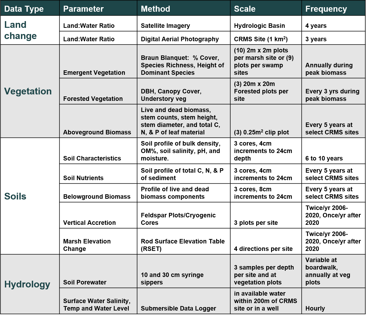
Q. What parameters are measured through CRMS, how and when are they measured?
A.
Q. How do I interpret the CRMS station naming convention (ex., CRMS0002-V01, CRMS0002-A13, etc)?
A. CRMS
site names are indicated by CRMSXXXX, where XXXX is a four digit number. CRMS
station names begin with the CRMS site number, followed by a hyphen, and the station number (ex., CRMS0002-A01). There are many stations within a CRMS site. For additional details of station naming conventions and general CRMS data collection schedule, click
here
Q. How do I download data?
A. Use
cims.coastal.louisiana.gov if you are looking for raw data for a specific data type (ex., hourly salinity, station level herbaceous vegetation, etc.). If you are looking for calculated data (ex., averages, marsh classification, elevations, elevation change rates, CRMS indices) click the data icon on the CRMS homepage.
Q. What unit are the water elevation data in?
A. ft NAVD88
Q. Where should I go to visualize hydrologic data to investigate what data are available?
A. Mouse over the Visualization tab, click Charting, click Hydro, then click the Interactive Hydro link.
Q. I don't know the CRMS site ID's to request data. What should I do?
A. Hover over the CRMS site symbology (yellow dots) in the mapping viewer and the site number will appear at the bottom left hand corner of the map.
Q. Is there a file available so that I can see the CRMS site locations in Google Earth?
A. Yes, go to the mapping viewer. Expand the CRMS layer menu and click on the "Download KML" link.
Q. How do I find out more about soil properties data collected at CRMS and SWAMP stations?
A. Click
here to access the Soils Data Information Read Me document.
Click
here for a list of sites sampled through the SWAMP program.