The basin contains about 312,500 acres of wetlands, consisting of 32,800 acres of fresh marsh, 112,000
acres of intermediate marsh, 158,200 of brackish marsh, and 9,500 acres of
saline marsh. A total of 122,000 acres have been lost since 1932,
28 percent of the marsh that existed in 1932.
Marshes within the Sabine Basin began forming about 3,500 years ago. Whenever
the Mississippi River established a westerly course, large quantities of
reworked riverine sediment were deposited along the gulf shore, resulting in
southerly growth of the shoreline. When the Mississippi River shifted to an
easterly course, the sediment supply decreased and erosive forces were greater
than sediment deposition due to littoral drift. As a result, the shoreline
converted to a more typical beach-like nature and gradually retreated. The
repetitive occurrence of these pulses of sediment due to change in the
Mississippi Rivers course helped to build the systems of cheniers (oak ridges)
in the basin.
The progradation process served to establish an undulating land form along
the gulf coast. The areas between the cheniers were collecting points for water
and, over time, built up by decomposition and regeneration of plant materials to
form low salinity marshes. These interior marsh areas would occasionally receive
pulses of mineral sediment input due to storm tides.
Calcasieu and Sabine lakes are the major water bodies within the basin.
Freshwater inflow to the basin occurs primarily through these lakes via the
Calcasieu and Sabine rivers. Marshes within the basin historically drained into
these two large lakes. This process was altered by the construction of channels
to enhance navigation and mineral extraction activities. Navigation channels now
dominate the hydrology of the basin. The Calcasieu Ship Channel is maintained at
40 feet deep by 400 feet wide and extends from the Gulf of Mexico to Lake
Charles, Louisiana. The GIWW is maintained at 12 feet deep by 125 feet wide. The
reach of the GIWW between the Sabine River and the Calcasieu Ship Channel was
dredged to a depth of 30 feet in 1927. The Sabine-Neches Waterway, between the
Gulf of Mexico and Port Arthur, Texas, is 40 feet deep by 400 feet wide.
The hydrology of the marshes between Sabine and Calcasieu lakes has also been
altered by numerous relatively small access canals. The GIWW and this network of
canals have established a hydrologic connections between the Sabine and
Calcasieu Estuaries. Additionally, a number of bayous which once drained
adjacent marshes into either of the estuaries have been connected to one
another. Consequently, marshes between Sabine and Calcasieu Lakes have become a
large interlinked system with water draining and circulating to the northern,
eastern, and western portions of the basin.
The water circulation patterns allow for higher salinity water to enter the
interior marshes (saltwater intrusion). The basin soils, which are
87 percent organic and support lower salinity marsh vegetation, are
infiltrated by the more saline waters. This leads to increased stress and loss
of the plant communities, and eventually erosion and sediment transport out of
the inner marsh areas.
Subsidence and sea level rise are natural processes that contribute to
wetland deterioration and loss. Under pristine conditions, natural marsh
building and maintenance processes are effective in maintaining coastal marshes
despite subsidence and sea level rise; however, human alterations have disrupted
the hydrologic processes which contributed to wetland building and maintenance,
while subsidence and sea level rise continues. In the Sabine Basin, subsidence
and sea level rise result in an average water level rise of 0.25 inches per
year. Although natural wetland building processes no longer occur, natural marsh
maintenance processes can be fairly effective at keeping wetland loss rates low.
Erosion is a problem along the shores of Calcasieu and Sabine lakes and the
banks of the GIWW. Erosion related breaching of the lakes shores threatens
adjacent marshes because of the vulnerability of their typically weaker soils to
increased water exchange and saltwater intrusion. Along the Gulf of Mexico,
shoreline retreat is causing the loss of back-beach marshes and is threatening
to alter the hydrology of interior marshes. Flood control projects on the
Mississippi and Atchafalaya rivers, and construction of jetties on the Mermentau
River, Calcasieu Ship Channel, and at Sabine Pass, have altered long shore
sediment transport and sediment availability.
In summary, wetland loss within the basin is largely the result of extensive
hydrologic alterations to wetland building and maintenance processes. Recent
observations regarding marsh recovery indicate that in some areas, reducing
salinities may protect and restore wetlands.
Projects in the Calcasieu / Sabine Basin
Summary of the Basin Plan
STUDY AREA
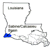
The Calcasieu/Sabine Basin is located in southwest Louisiana in Cameron and
Calcasieu parishes and consists of approximately 630,000 acres. The northern
boundary of the basin is defined by the Gulf Intracoastal Waterway (GIWW). The
eastern boundary follows the eastern leg of State Highway 27; the western
boundary is the Sabine River and Sabine Lake; and the southern boundary is the
Gulf of Mexico (Figure CS-1). About 24 percent (148,600 acres) of the basin
lands is publicly owned as Federal refuges.
EXISTING CONDITIONS AND PROBLEMS
The basin contains about 312,500 acres of wetlands, consisting of 32,800
acres of fresh marsh, 112,000 acres of intermediate marsh, 158,200 of brackish
marsh, and 9,500 acres of saline marsh. A total of 122,000 acres have been lost
since 1932, 28 percent of the marsh that existed in 1932.
Marshes within the Calcasieu/Sabine Basin began forming about 3,500 years
ago. Whenever the Mississippi River established a westerly course, large
quantities of reworked riverine sediment were deposited along the gulf shore,
resulting in southerly growth of the shoreline. When the Mississippi River
shifted to an easterly course, the sediment supply decreased and erosive forces
were greater than sediment deposition due to littoral drift. As a result, the
shoreline converted to a more typical beach-like nature and gradually retreated.
The repetitive occurrence of these pulses of sediment due to change in the
Mississippi Rivers course helped to build the systems of cheniers (oak ridges)
in the basin.
The progradation process served to establish an undulating land form along
the gulf coast. The areas between the cheniers were collecting points for water
and, over time, built up by decomposition and regeneration of plant materials to
form low salinity marshes. These interior marsh areas would occasionally receive
pulses of mineral sediment input due to storm tides.
Calcasieu and Sabine lakes are the major water bodies within the basin.
Freshwater inflow to the basin occurs primarily through these lakes via the
Calcasieu and Sabine rivers. Marshes within the basin historically drained into
these two large lakes. This process was altered by the construction of channels
to enhance navigation and mineral extraction activities. Navigation channels now
dominate the hydrology of the basin. The Calcasieu Ship Channel is maintained at
40 feet deep by 400 feet wide and extends from the Gulf of Mexico to Lake
Charles, Louisiana. The GIWW is maintained at 12 feet deep by 125 feet wide. The
reach of the GIWW between the Sabine River and the Calcasieu Ship Channel was
dredged to a depth of 30 feet in 1927. The Sabine-Neches Waterway, between the
Gulf of Mexico and Port Arthur, Texas, is 40 feet deep by 400 feet wide.
The hydrology of the marshes between Sabine and Calcasieu lakes has also been
altered by numerous relatively small access canals. The GIWW and this network of
canals have established a hydrologic connections between the Sabine and
Calcasieu Estuaries. Additionally, a number of bayous which once drained
adjacent marshes into either of the estuaries have been connected to one
another. Consequently, marshes between Sabine and Calcasieu Lakes have become a
large interlinked system with water draining and circulating to the northern,
eastern, and western portions of the basin.
The water circulation patterns allow for higher salinity water to enter the
interior marshes (saltwater intrusion). The basin soils, which are 87 percent
organic and support lower salinity marsh vegetation, are infiltrated by the more
saline waters. This leads to increased stress and loss of the plant communities,
and eventually erosion and sediment transport out of the inner marsh areas.
Subsidence and sea level rise are natural processes that contribute to
wetland deterioration and loss. Under pristine conditions, natural marsh
building and maintenance processes are effective in maintaining coastal marshes
despite subsidence and sea level rise; however, human alterations have disrupted
the hydrologic processes which contributed to wetland building and maintenance,
while subsidence and sea level rise continues. In the Calcasieu/Sabine Basin,
subsidence and sea level rise result in an average water level rise of 0.25
inches per year. Although natural wetland building processes no longer occur,
natural marsh maintenance processes can be fairly effective at keeping wetland
loss rates low.
Erosion is a problem along the shores of Calcasieu and Sabine lakes and the
banks of the GIWW. Erosion related breaching of the lakes shores threatens
adjacent marshes because of the vulnerability of their typically weaker soils to
increased water exchange and saltwater intrusion. Along the Gulf of Mexico,
shoreline retreat is causing the loss of back-beach marshes and is threatening
to alter the hydrology of interior marshes. Flood control projects on the
Mississippi and Atchafalaya rivers, and construction of jetties on the Mermentau
River, Calcasieu Ship Channel, and at Sabine Pass, have altered long shore
sediment transport and sediment availability.
In summary, wetland loss within the basin is largely the result of extensive
hydrologic alterations to wetland building and maintenance processes. Recent
observations regarding marsh recovery indicate that in some areas, reducing
salinities may protect and restore wetlands.
FUTURE WITHOUT-PROJECT CONDITIONS.
Land loss data for the period 1933 to 1990 reveals that 122,000 acres of
wetlands have been lost in the basin. The current wetland loss rate of 1,100
acres per year is based on composite data for the period of 1974 to 1990. Table
CS-1 shows the projected wetland loss over 20- and 50-year periods under the no
action alternative.
Table CS-1
Projected Marsh Loss
Projected Loss at 20 yrs. Projected Loss at 50 yrs.
Subbasin (Acres) (Percent) (Acres) (Percent)
Calcasieu 9,400 9.5 23,400 23.7
Sabine 12,500 8.4 31,200 20.9
Totals 21,900 8.9 54,600 22.0
BASIN PLAN
The Calcasieu/Sabine Basin Plan (Figure CS-2) has two possible strategies to
reduce the effects of saltwater intrusion and tidal scour: locks in the major
waterways or structures in the many canals where saltwater enters interior
marshes.
The latter is more cost effective and can be completed in a shorter time. The
short-term projects in the plan include shoreline and bank protection,
hydrologic restoration, freshwater introduction, marsh management, marsh
creation with dredged material, and terracing. An additional freshwater
introduction project is a long-term project in the basin plan. A detailed
description of the plan formulation and evaluation is contained in Appendix I.
The core of the plan is structures at points where saltwater enters smaller
canals that lead to interior marshes: the perimeters of Calcasieu and Sabine
lakes, the Gulf of Mexico, and major waterways. This treats the adverse effects
of basin-wide hydrologic alterations. Hydrologic restoration projects at Black
Lake, Rycade Canal and twelve other areas, and marsh management in the
Cameron-Creole area and at Brown Lake, are critical in preserving marshes.
Shoreline protection projects at Sweet and Willow Lakes, from Constance Beach to
Ocean View, and at five others sites, are also critical in preserving marsh.
Freshwater introduction from the Toledo Bend Reservoir and marsh creation with
dredged material from the Calcasieu Ship Channel are other critical projects.
All these projects meet the key objectives of preserving marsh by restoring
hydrology and maintaining the geological framework of the basin.
The availability of suspended sediment is limited throughout most of the
basin. Freshwater diversions have been incorporated into projects where nutrient
and sediment introduction may benefit wetlands. To the degree possible, actively
managed perimeter structures will be opened during periods when nutrients and
sediments can be introduced into wetlands.
Supporting projects are located in interior large open water areas and other
severely eroding areas where perimeter projects alone would not provide a
sufficient degree of protection or restoration. Bank protection at Johnsons
Bayou; hydrologic restoration at Oyster and Mud Bayous and other sites; marsh
management in Tripod Bayou, East Mud Lake, and Black Lake; marsh creation at Hog
Island Gulley; beach nourishment with dredged material; freshwater introduction
from the GIWW; sediment and nutrient trapping in Deep Lake and Browns
Lake-Starks Canal area; and terracing are all supporting projects. These
short-term projects help preserve the wetlands of the basin
Table CS-2 lists all the projects in the selected plan. A detailed
description of projects in the selected plan can be found in Appendix I.
COSTS AND BENEFITS
The selected plan projects will protect, restore, or preserve 24,810 acres of
wetlands at a cost of $136,460,000. The plan will prevent all of the marsh loss
expected to occur over the next twenty years, producing a net gain of 2,910
acres of wetlands over this same period.
Back to Top
Dynamics of the Basin
The Calcasieu/Sabine Basin is located in southwest Louisiana and is the
westernmost coastal basin not only in the chenier plain but also in the state of
Louisiana. The approximate northern boundary of the basin is the GIWW, the
eastern boundary follows the eastern leg of Louisiana Highway 27, the western
boundary is the Sabine River and Sabine Lake, and the southern boundary is the
Gulf of Mexico (figure 30).
Calcasieu and Sabine lakes dominate this basin's hydrology. Also influencing
the basin's hydrology are the Sam Rayburn and Toledo Bend reservoirs and three
major navigation channels-the Calcasieu Ship Channel, the Sabine-Neches
Waterway, and the GIWW. The basin encompasses approximately 630,000 acres of
land, 50% of which is classified as marsh. The marshes between Sabine and
Calcasieu lakes range from saline to fresh with saline marshes located primarily
near Calcasieu Lake and Sabine Pass. Brackish marshes are located adjacent to
both lakes and extend inland, graduating into intermediate and fresh marshes.
On a geologic time scale, longshore sediment transport associated with
delta-building and accumulation of organic material through vegetative growth
resulted in marsh building within the Calcasieu/Sabine Basin. However,
implementation of flood control and navigation projects on the Mississippi and
Atchafalaya rivers interrupted those natural processes. Consequently, mineral
marsh building within the basin has halted and the basin is experiencing net
shoreline erosion and marsh loss. Subsidence and sea level rise also contribute
to wetland deterioration and loss, and result in an average water level rise of
0.25 inches/year (Penland et al. 1989).
Almost all fresh marsh was converted to intermediate and brackish by the late
1970s as a result of saltwater intrusion and increased tidal influence.
Hydrologic alterations within the basin also impact sediment introduction into
affected marshes. Jetties on the Calcasieu Ship Channel and at Sabine Pass
affect longshore sediment transport and sediment availability. Also, spoil banks
and levees associated with navigation channels retard the flow of nutrients and
fine suspended sediments into the basin's marshes, while limiting the export of
organic material.
Erosion is a problem along the banks of the GIWW and the shores of Calcasieu
Lake, Sabine Lake, and interior marsh water bodies. Erosion-related breaching of
the shorelines and levees exposes the fragile interior marshes to increased
water exchange and saltwater intrusion, resulting in loss of surface layers of
organic material (USDA-NRCS {in print}). Along the Gulf of Mexico, shoreline
erosion causes loss of back beach marshes and also threatens to alter the
hydrology of nearby interior marshes.
A total of 116,791 acres (33% of the historic land area) of wetlands in the
Calcasieu/Sabine Basin has converted to open water since 1932 (Dunbar et al.
1992, figure 30). Extensive channelization, increased energy levels, and
saltwater intrusion caused much of the marsh loss in the basin. Current land
loss rates range between approximately 1,000 (Dunbar et al. 1992) and 1,650
(Barras et al. 1994) acres per year. At these rates, up to 33,000 acres will be
lost during the next 20 years if coastal restoration projects are not
implemented.
Back to Top
Discussion
Many of the CWPPRA projects address the problems associated with the navigation channels either
through bank protection measures or through marsh management and hydrologic restoration
techniques. Since most of the CWPPRA projects in the Calcasieu/Sabine Basin have either not
been implemented yet or have only recently been constructed, their performance cannot be
evaluated at this time. However, the success of past state-sponsored projects which utilize
the same technologies as CWPPRA projects suggests that wetland loss is being addressed
effectively in the basin